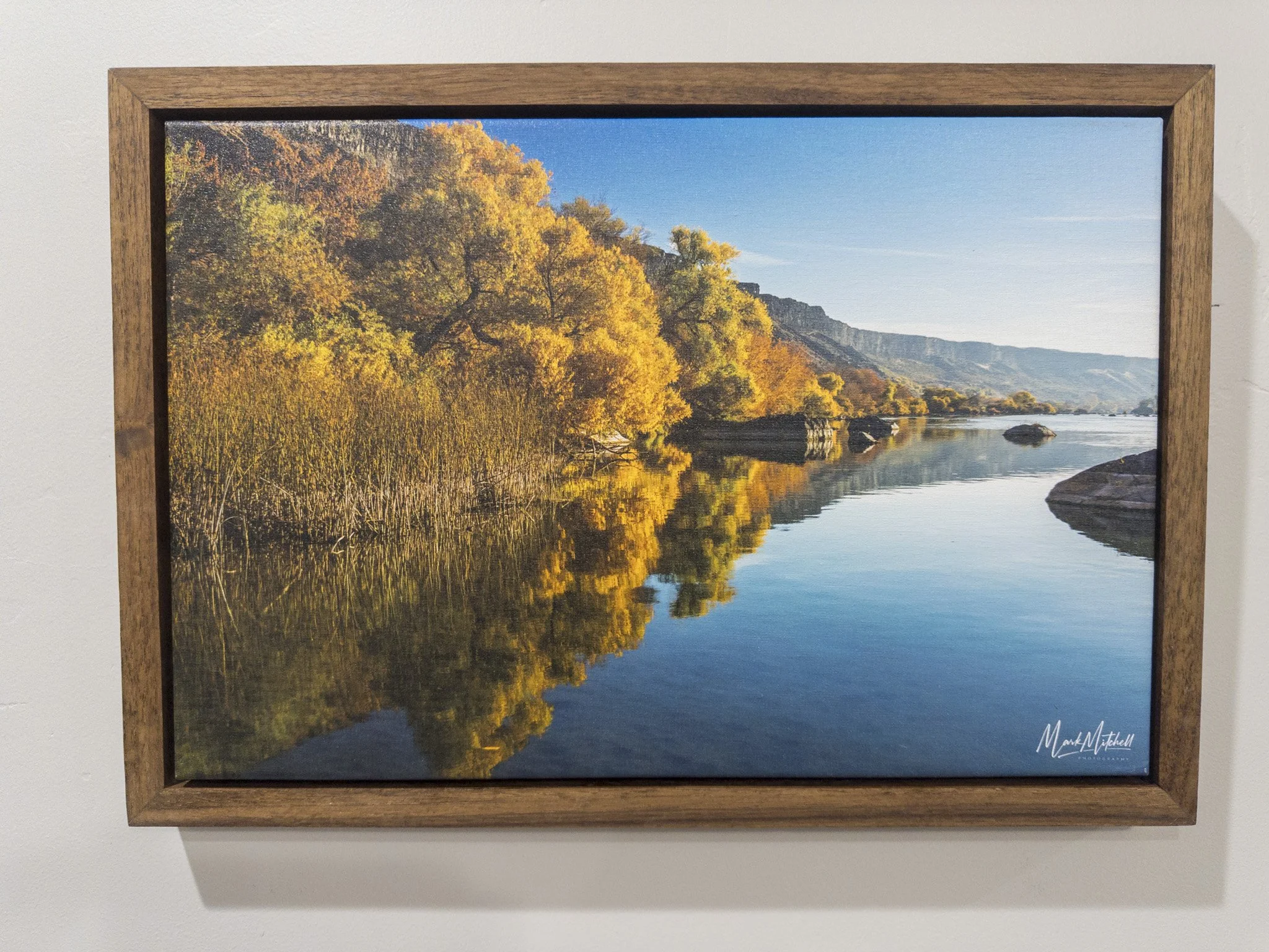
 Image 1 of 3
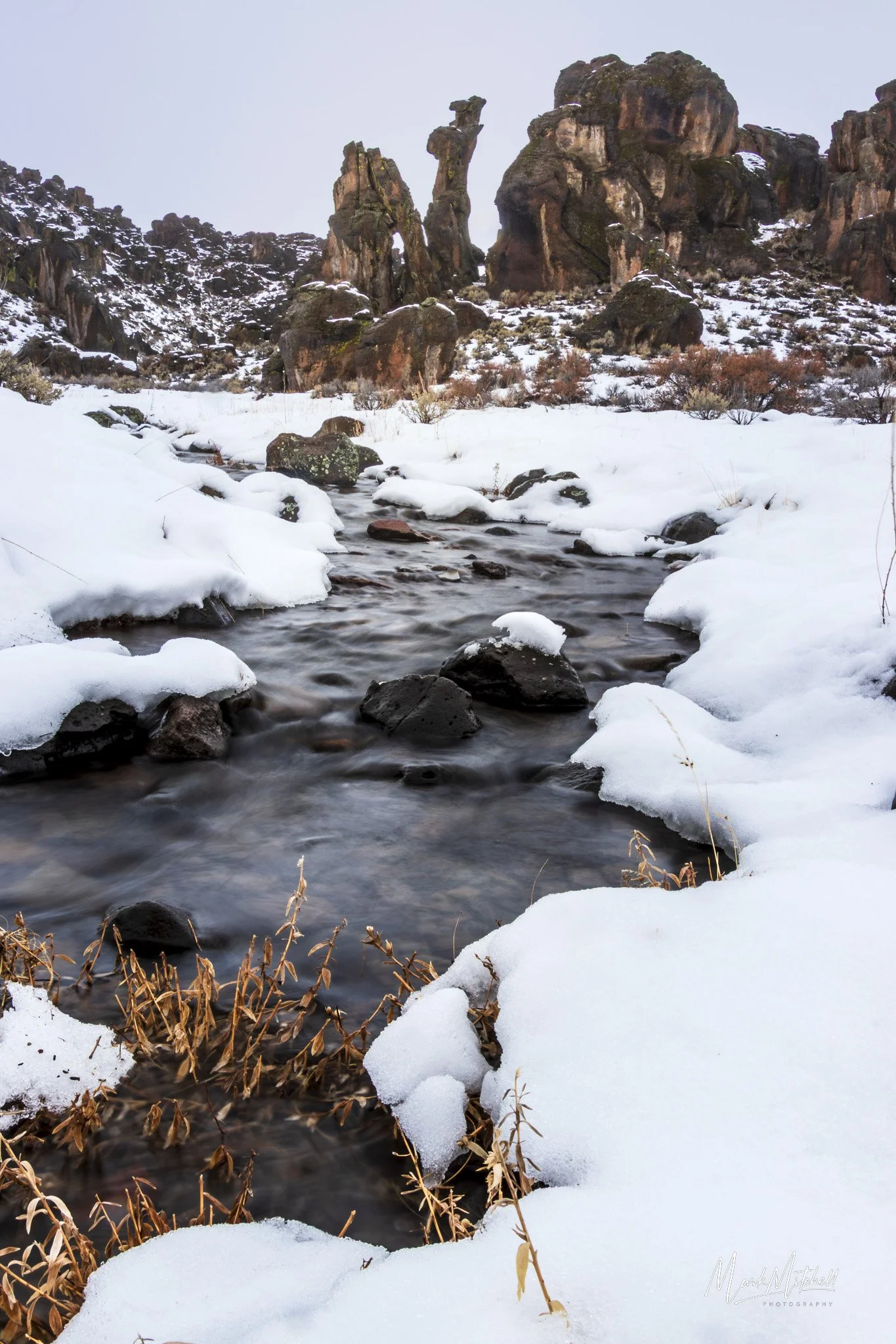 Image 2 of 3
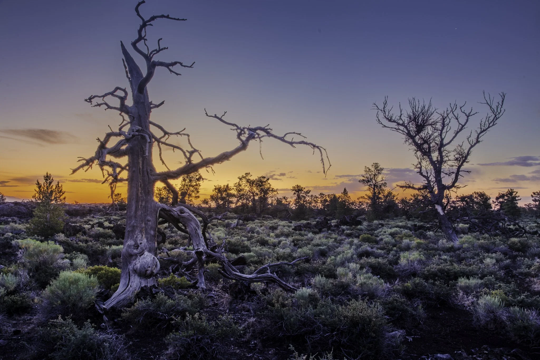
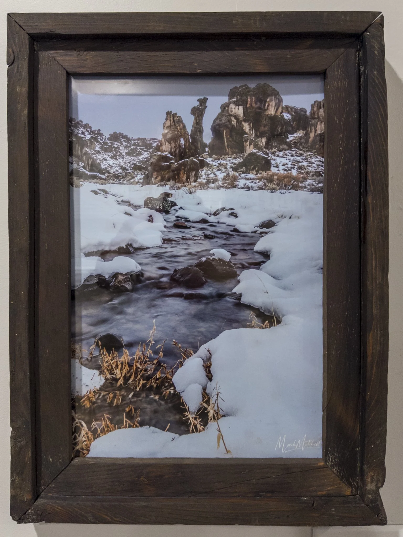
 Image 3 of 3
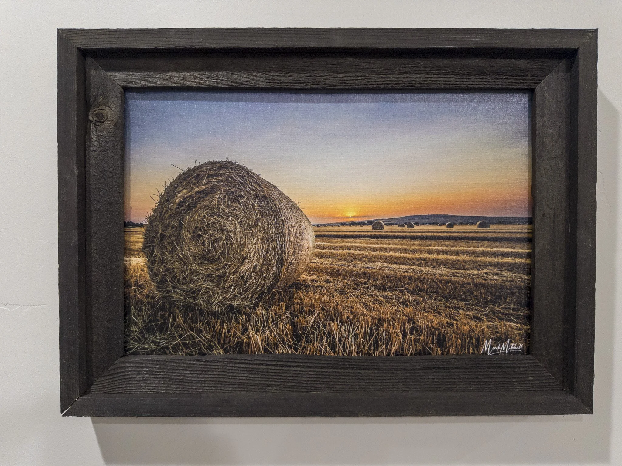
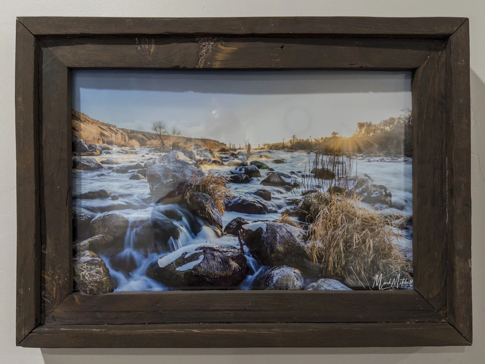
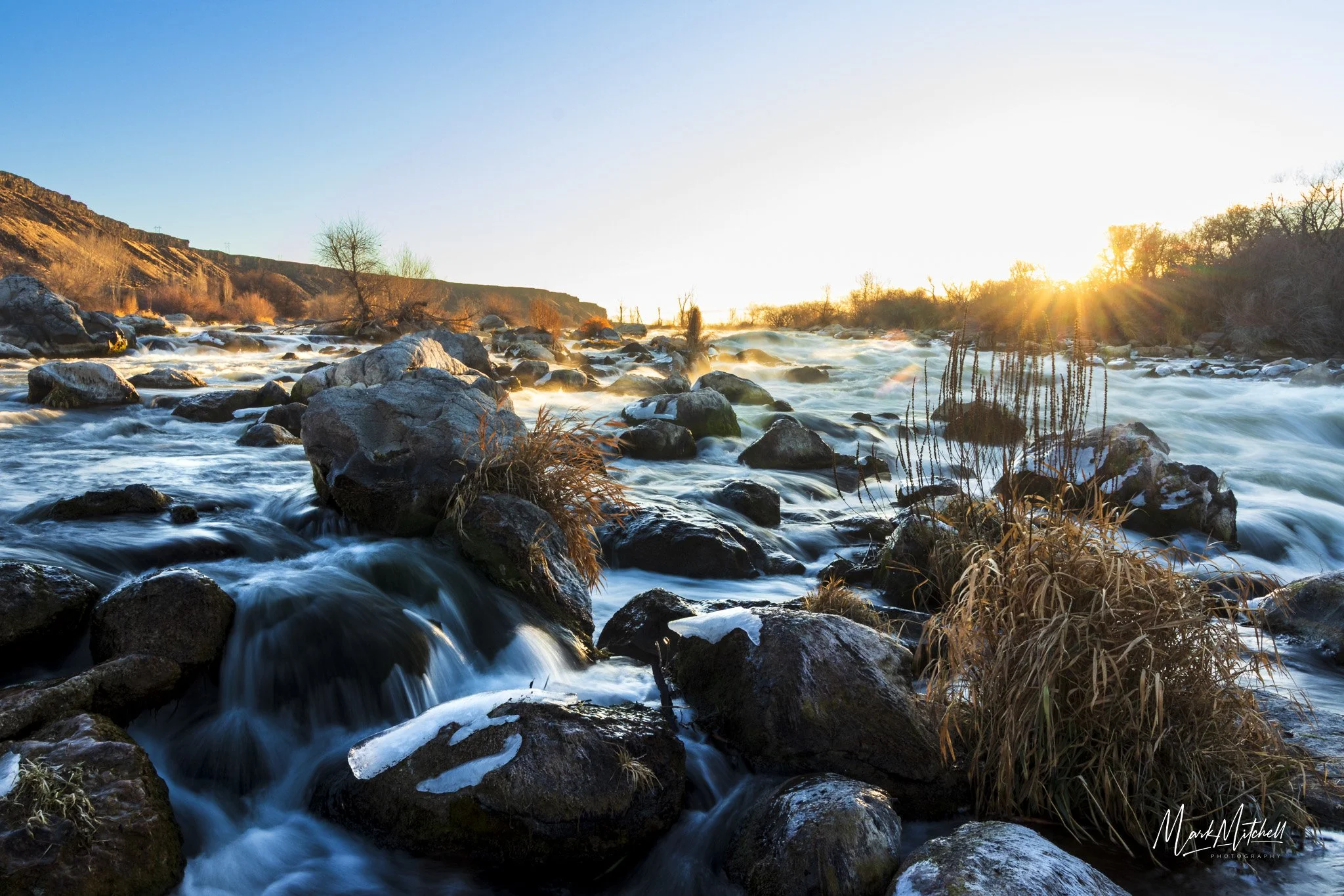
Vertical orientation. This fine art paper print, framed in a barn wood frame with a medium Danish oil finish hand-crafted by the photographer, is truly unique and one-of-a-kind. Available also as a print only, in three optional sizes and materials.
Little City of Rocks, about 10 miles north of Gooding, is sometimes confused with City of Rocks National Reserve on the Southern border of Idaho, but the locations and rock formations are quite different. In many areas the rock columns stand in rows, looking like tall city buildings. Those seen in this image are iconic formations seen in most photos of the area, as they are near the entrance and their unique shapes stand out. I first visited here in July, and although the area was hot and very dry, the dry creek beds were prominent, and it was evident that water flows through along the trail sometimes. In January 2025 I decided to make another visit, and there was quite a lot of snow melting off, and the creek was full. I hiked in about half a mile, but my boots were not completely waterproof, so I didn’t explore much further. During the time that I was there though, the water flow doubled, and on my way out I took this image. There really isn’t much place for the water to flow other than out toward the highway, and the dirt road that leads to the entrance was quickly becoming a creek itself! I had driven my Camry in and I started getting a little concerned that I might not get back out! Luck was on my side that day!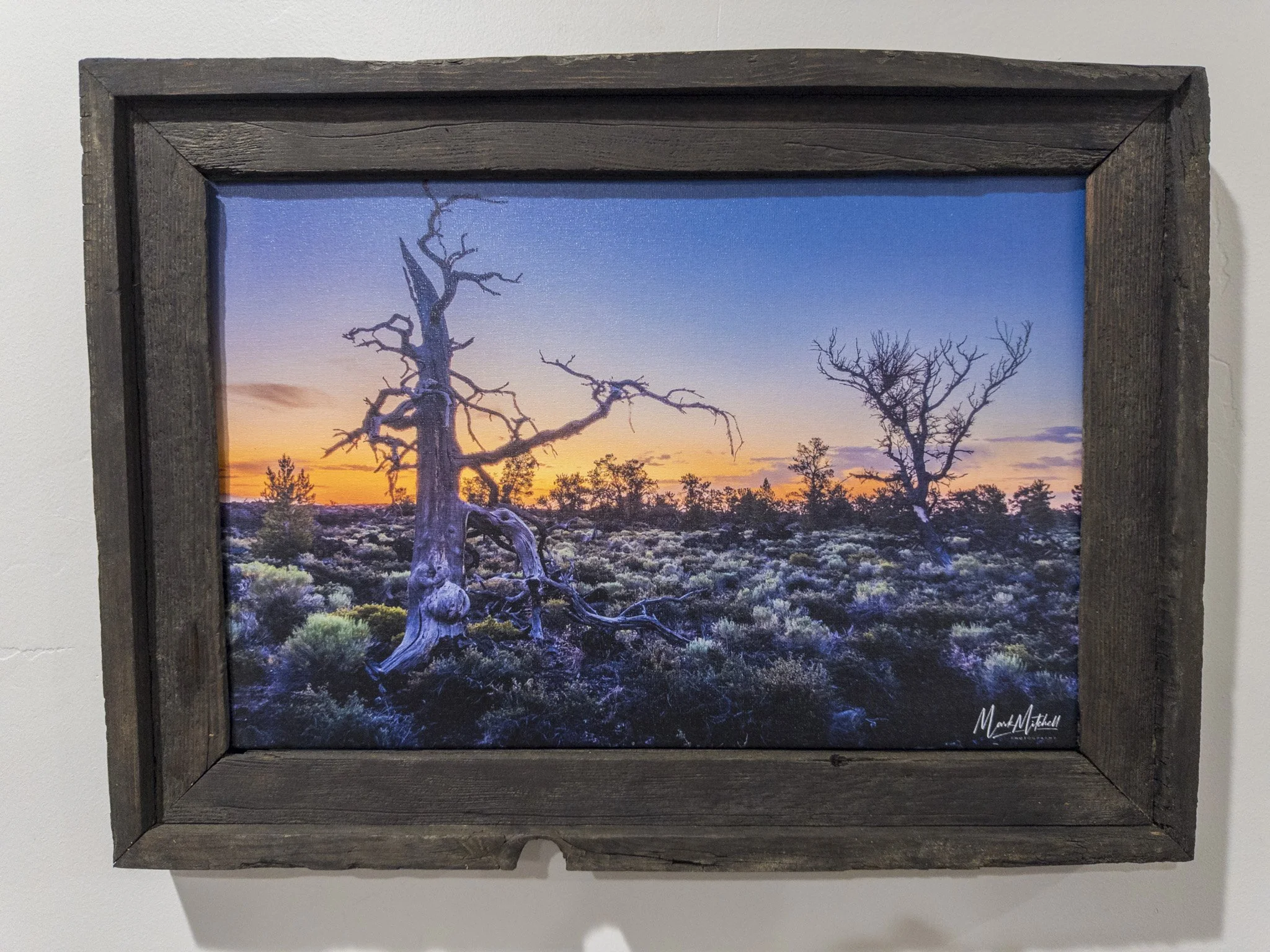